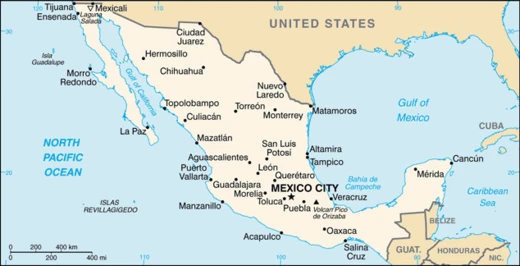
Aguascalientes (city)
Capital of Aguascalientes state, founded on hot springs.

Aguascalientes is the capital of the Mexican state of Aguascalientes and its most populous city, as well as the head of the Aguascalientes Municipality. The city served as an outpost on the Silver Route and was part of the kingdom of Nueva Galicia.
- Climate
- Semi-arid (Köppen BSh)
- Known for
- San Marcos Fair, Nissan manufacturing plants, hot springs
Lore & Background
The village was originally conceived as a minor garrison and rest stop between the cities of Zacatecas and Lagos de Moreno, with the end goal of protecting silver in its route to Mexico City from the Chichimeca. The historical center of Aguascalientes was born out of four distinct neighborhoods. The fourth neighborhood, Barrio de la Salud, developed around a small chapel and cemetery built towards the end of the 18th century to deal with disease epidemics. A fifth neighborhood, Barrio de la Estación, named after the central train station, is often grouped with the original neighborhoods but is considerably more modern.
Reader's Guide
Aguascalientes holds significance as a historical outpost on the Silver Route and as a political and industrial center in Mexico. During the Porfiriato era, the city became an industrial hub when it hosted the main workshops of the Mexican Central Railway company, bringing an industrial and cultural explosion. In contemporary times, Aguascalientes has attracted foreign investment from automobile and electronics companies, including two Nissan manufacturing plants and a shared facility by Nissan and Mercedes, leading to a significant Japanese immigrant community. The city is also known for the San Marcos Fair, the largest fair celebrated in Mexico and one of the largest in North America. Its historical neighborhoods, with their distinct origins and architecture, contribute to the city's cultural heritage.
Did You Know?
- The name Aguascalientes means 'hot waters' in Spanish, referring to the thermal springs found near the village.
- The city is home to two Nissan automobile manufacturing plants and a shared facility by Nissan and Mercedes.
Origins & the Silver Route
The territory that would become Aguascalientes was home to nomadic Chichimeca peoples long before European contact. The village was conceived as a modest garrison and waystation between Zacatecas and Lagos de Moreno, tasked with guarding silver shipments bound for Mexico City against Chichimeca raiders. Politically, it fell under the kingdom of Nueva Galicia. Though its founders had no vision of a major metropolis, the settlement would grow into the capital of a state with over a million metro-area residents.
Political Ascent & Revolutionary Crossroads
What began as a minor outpost on the Silver Route underwent a dramatic political transformation in the nineteenth century. The city's strategic position on the central Mexican plateau made it a natural gathering point for political and military leaders. During the Porfiriato, the Mexican Central Railway selected Aguascalientes as the site for its principal workshops, igniting a wave of industrial and cultural development that reshaped the urban landscape. From garrison to state capital to revolutionary meeting ground, Aguascalientes repeatedly found itself at the center of Mexico's shifting power structures.
Industrial Heritage & Global Manufacturing Hub
Aguascalientes built its economic identity on a foundation of farming, mining, and later railroad and textile production. The Porfiriato-era decision to locate the Mexican Central Railway's main workshops in the city triggered an industrial and cultural boom that set the stage for modern growth. Today, the city's peaceful business climate, central location in North-Central Mexico, and well-developed infrastructure have drawn substantial foreign investment in the automobile and electronics sectors. Two Nissan manufacturing plants operate in the city, alongside a shared facility with Mercedes-Benz, and the presence of these Japanese automakers has fostered a notable Japanese immigrant community. Other major employers include Jatco, Coca-Cola, Flextronics, Texas Instruments, Donaldson, and Calsonic Kansei. This manufacturing ecosystem represents a dramatic evolution from the silver-guarding garrison of the sixteenth century, yet the city's strategic position on the central plateau remains the same geographic advantage that first made it valuable to colonial authorities.
Living Neighborhoods & the San Marcos Fair
The historical center of Aguascalientes grew organically from four distinct barrios, each with its own character and sacred architecture. The Barrio de Guadalupe developed along a trading road and is distinguished by its Spanish Baroque church with a Talavera-tiled dome. The Barrio de la Salud grew from a cemetery and chapel established during late-eighteenth-century epidemics, retaining its working-class single-story character to this day. Above all, the San Marcos Fair—celebrated in the city's most sacred neighborhood—stands as the largest fair in Mexico and one of the largest in North America.
Frequently Asked Questions
Who is Aguascalientes (city)?
Aguascalientes is the capital and most populous city of the Mexican state of Aguascalientes. It also functions as the administrative seat of the Aguascalientes Municipality.
What are Aguascalientes (city)'s powers/role?
The city is widely recognized for three defining features: the San Marcos Fair, its Nissan manufacturing plants, and the natural hot springs around which it was originally founded. Together these shape its cultural, industrial, and recreational identity.
How does Aguascalientes (city)'s story end?
As a living settlement, Aguascalientes has no final chapter; it continues to operate as the state capital and a central industrial hub in northern Mexico. Its ongoing legacy is anchored in the automotive sector and its annual cultural celebrations.
Why is Aguascalientes (city) important?
Historically the settlement acted as a strategic outpost along the colonial Silver Route and fell under the jurisdiction of the kingdom of Nueva Galicia. In the modern era it remains economically vital as the state's capital and a key manufacturing center.
What is Aguascalientes (city)'s natural setting?
The city sits in a semi-arid climate zone (Köppen BSh), characterized by hot summers and mild winters. Its very founding was tied to geothermal hot springs that still define the local landscape.
More in Mexican Cities 1-20
Spotted an error? Know more?
This is a living reference — every entry is fact-audited, and reader corrections feed straight into our audit queue. Suggest an edit · See this site's audit record